High Pyrenees, 22-30 August 2019
← Previous Next → 0 1 2 3 4 5 6 7 8 9
Day four. Posets.
We did a circular route of Posets. We went up the east face until we got to a ledge leading to the east ridge, and then climbed the ridge to the top. This is arguably the best way of climbing Posets (see route description on youtube and komandokroketa). There are alternatives, e.g., direct ascent of the east face, but there is too much loose rock to make this comfortable. Or one can climb the east ridge directly from Collado de la Paúl. This would be a little harder, and the rocks at the beginning of the ridge are unstable. There was no snow on the ledge when we were climbing it but it is usually filled with snow earlier in the season. The ledge is very easy to find if one aims at a quartz vein resembling a dog (see picture below) which can be seen from below. The ledge is above the boundary between grey and orange-red rocks. The grey rocks are of poor quality but the orange-red ones are very good (although there is still plenty of loose rock). Getting to the ledge is a walk rather than a scramble (particularly without big backpacks!), and the rest of the route is a reasonable scramble (similar to UK grade 1-2 scrambling), there is no need for a rope. The exposure however is quite dramatic in places. We put Sonya in a rope team for purely psychological reasons and didn't even try to belay her. She knew this but still felt more comfortable in a rope team.
There were no people on the ridge, but the summit and the main path from the South were very busy. We started descending the main path and then turned left to cross a rocky ridge. Here we made a mistake: instead of traversing the scree, we followed a clear path down and got to the ridge some 30 m below the pass. For some reason we decided not to climb back but to descend further until the next pass where we crossed the ridge to the other side.
The blue line shows our track. The arrows show direction of travel, and the tent icon shows our camp on the snow. Shift-click on the track link will open it in nakarte.me.
Although we got up quite early, we did not manage to start walking until 8 am. At least the sunrise was great. We are ready to climb. Posets is basking in the sun.

We crossed a small snow field (all that is left of the Posets glacier) and started going up a scree.

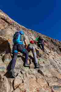
One can continue walking from this place to the ledge (we checked) but we decided to climb the rocky face instead, just for fun. We eventually got to the same ledge.
 |
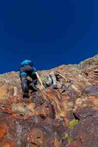 |
The climb was fairly steep but the rock was good and there were lots of large holds and cracks.

We are in the world of mountains.

This is the quartz vein which looks like a dog. The ledge can be seen below the quartz vein, it traverses the whole face.
|
|
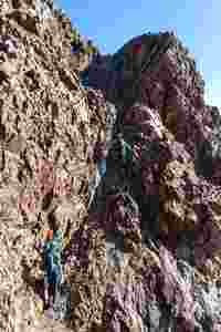 |
The ledge is very flat, as though it was deliberately cut in the rock. |
But then it climbs much more steeply, leading to the ridge. We then turned left to follow the ridge up. |
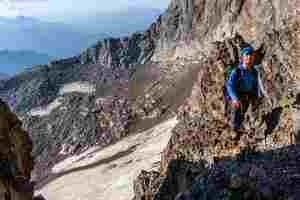
Victor is waiting for his turn.
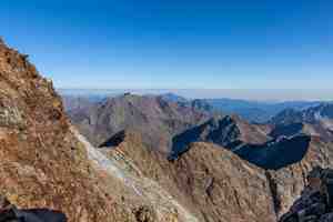
A view from the ridge.

The scramble up the ridge is fairly easy. The ridge is quite broad in places, and when it sharpens, one can climb just below the top of the ridge and use the handholds on the ridge.
This ridge looks quite impressive but in reality this is easy walking. The summit is close.
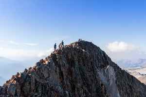
This is Posets at 3369 m, the second highest peak in the Pyrenees.
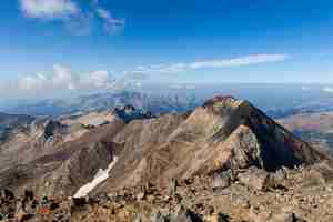
Stripy rocks.
Looking back at our camp. One can even make out our tents on the snow.

Running down a good path is easy.
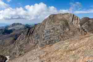
A flattened peak of Diente de Llardana.
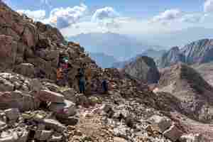
We made a mistake a minute ago, we should have traversed the scree rather than follow this obvious path down.

This is the lower pass through the ridge, it is a short section of easy scramble.
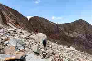
We got back to our tents just in time for lunch. We packed our backpacks and went down. It was going to be a long day. We are leaving Collado de la Paúl at the beginning of our descent. The path goes down an easy scree, so we are moving fairly quickly.
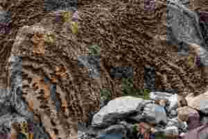
There were some amazing "tiger" rocks in this valley. They are all in rusty stripes and heavily weathered.

The further down, the more colouful the mountains.
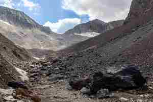
Looking back at Collado de la Paúl (hover the mouse over the picture to see the annotations). Glacier de la Paúl used to fill this valley, but now it is all but gone. There is hardly any snow in the valley and no ice.
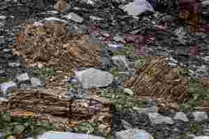
The "tiger" rocks.
We are descending into Estós valley.
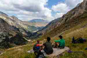
Refugio Estós (1890 м) is somewhere down there.
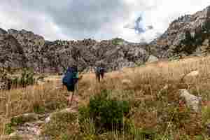
We went past the refuge and found our path just behind the toilet block. The path goes towards Ibones de Gías o de O. It follows a stream up, but there was not much water in the stream. We were prepared to camp far away from any water sources, and go fetch water in the evening, we had 9 water bottles 2 L capacity each. Fortunately however there was some water in the stream, and we set up a camp just 5 min away from the water source.

Enjoying raspberries.
We found a flat spot for the tents close to the path. This was a long day, altitude gain/loss was nearly 1000 m / 1750 m, respectively.


