The Dolomites, Padova and Venice
The Dolomites, 6–8 September 2025
At the beginning of September we went to the Dolomites. Vitya had a conference in Italy, and we decided to combine it with a mountain trip. We didn't bring ropes or harnesses, yet we did a few short scrambles, and the trip turned out wonderfully full-on and exciting. And beautiful, too!
Day One. Forcella del Piz di Sagron.
We arrived in Venice late in the evening, picked up the car, and spent the night at a campsite near the airport. In the morning we set off towards the Dolomites. Spotting an incredible cluster of contour lines on the map near the peak of Sagron, we knew that was exactly where we wanted to go.
The blue line shows our track. Shift-click the track link to open it in nakarte.me.
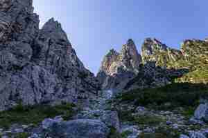
Climbing towards the Forcella del Piz di Sagron. We followed the bed of a dry river. During heavy rain, water runs here. Perhaps that's why the rocks are so clean and white?
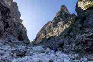
This gorge is always in shade, but the white stones were dazzling, almost like snow glare.
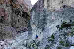
The pass is just around the corner. It took us a while to notice that the route was marked with orange paint. Route finding was not always easy, and the markings really helped.
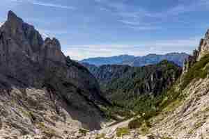
We traversed along the right-hand side of the gorge and crossed the ridge back into our valley.

This is the view of the pass from the other side. The ascent from here is much easier.
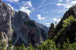
Water once flowed down this slope, splitting into two separate streams.
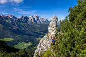
Before starting the descent, we wandered up to a nearby little summit.
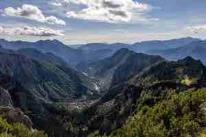
The Cogolate valley.
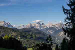
A small cloud caught on the sharp peak.
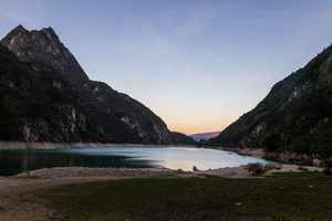
We rented a small cabin at a campsite on the shore of Lago del Mis. Strictly speaking, it's a reservoir, not a natural lake. The water was icy cold, but we still went in for a dip!
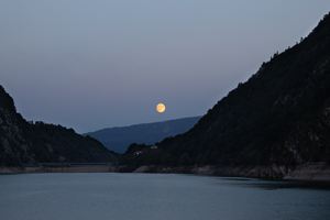
Full moon. We hardly met a soul all day in the mountains.
Day Two. Creste Fornel.
We had a long day ahead: the plan was to traverse the Fornel ridge. Hardly anyone goes there. Technically it's not too difficult; a bit of scrambling on the ascent to Pale dei Re. The climb up to the ridge is very steep and grassy, with the path not always obvious. The ridge itself isn't razor-sharp, but the slopes on both sides are extremely steep, you really wouldn't want to slip. Here is a description with photos. We set off around seven in the morning to enjoy the cool air and make it back before dark. The drive was short, about twenty minutes.
The blue line shows our track. Shift-click the track link to open it in nakarte.me.
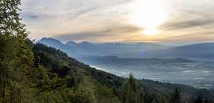
Sunrise over the Piave valley.
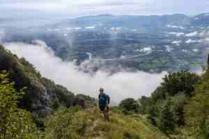
Clouds were creeping up from below.
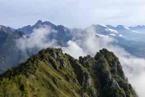
We reached a steep section of the ridge.
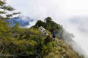
The path was faint, the slopes very steep, but we decided to press on; we could always turn back if needed.
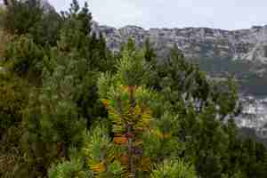
Low pines grow here, more like bushes than trees.

On the right, rocky cliffs; on the left, a steep grassy drop where stopping after a fall would be tricky. Clouds still rising from below.
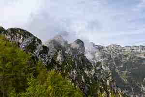
We followed the rocky crest towards the higher peak of Pizzocco, which in this photo is wrapped in cloud.
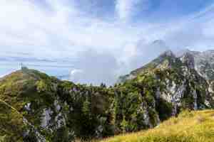
A cross on one of the summits. Beyond this, the ridge became much less sharp.
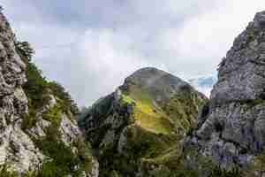
A glance back along the ridge we had just traversed.
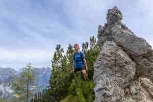
A lone rock pinnacle.
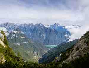
Far below, we could see Lago del Mis. The road runs along the near shore. The banks are mostly sheer cliffs, flattening out only at the headland where our campsite is.

Another jagged outcrop surrounded by low pines.
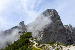
The toughest part was behind us. A good path led to the summit of Pizzocco. Here there were plenty of people around, but in the morning we had seen no one at all.
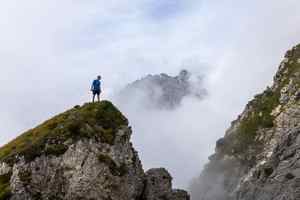
Clouds rising from the gorge below. The view changed minute by minute.

The summit of Pizzocco with its cross - one of three, in fact. We made it to the highest, true summit.
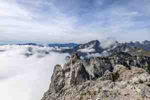
A sea of clouds beneath our feet.
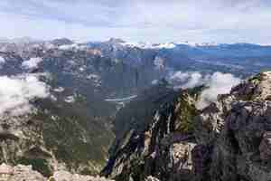
Lago del Mis from the top of Pizzocco. There is a path up the valley from the campsite, but it doesn't reach the ridge itself.
Day Three. Monte Messer.
That evening we had to return the car at the airport and reach our accommodation in Padova. We got up early and set off at dawn. Our final walk was in another part of the Dolomites, near the town of Belluno on the road towards Venice. No technical difficulties here, but the route was nonetheless beautiful.
The blue line shows our track. Shift-click the track link to open it in nakarte.me.

We left the car at a large car park at about 1200 metres near this café. It was closed, the tourist season was already over.
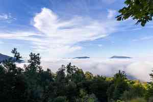
The clouds were below us: a beautiful cloud inversion.
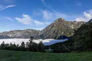
Cold air collects down in the valley, while a layer of warm air sits above it, forming clouds.
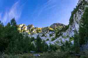
We climbed higher and found ourselves in a valley with white cliffs.
Small villages could be glimpsed beneath the clouds.
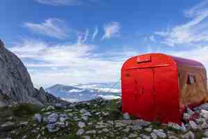
There is a refuge on the pass. It is a good shelter in case of bad weather, and you could even spend the night there if needed.
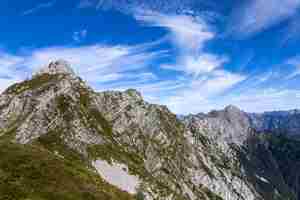
The clouds were particularly beautiful that day.
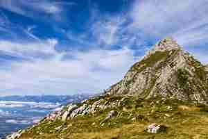
A short rest stop.
By midday the clouds had cleared, and in the distance we could see a large lake (Lago di Santa Croce).

Here and there we came across edelweiss.
With the help of the map and Google Earth we identified the distant peak in the centre of the photograph: it's Großglockner (3798 m) in faraway Austria, over 100 km away!
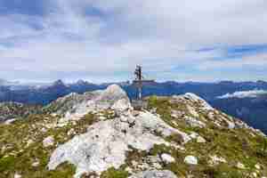
Mount Venal, our final destination. The small signboard shows a different name.

From here you can see the pass (where the red hut is) and the summit of Messer (centre of the photo), which we had climbed earlier that day.
To the east of the ridge lie forested hills and lake Lago di Barcis.
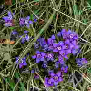
Field gentian (Gentianella campestris).

On the way down we entered the mist again and stopped taking photos. The path runs along the edge of a steep cliff. We had to descend more than a thousand metres.
The vegetation in the Dolomites is remarkable. This was our first time visiting in autumn: few flowers were still in bloom, and those that were looked quite different from summer species.
 |
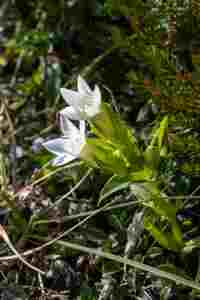 |
Cyclamen and field gentian (Gentianella campestris).
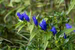
Willow gentian (Gentiana asclepiadea). Most likely, it's the same gentian as in the next photo, only this one has a horizontal stem, while the other grows vertically.
 |
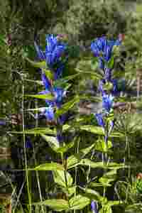 |
Fringed-flowered gentian (Gentianopsis ciliata) and willow gentian (Gentiana asclepiadea).
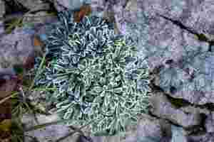
One of many saxifrages: silver saxifrage (Saxifraga crustata).
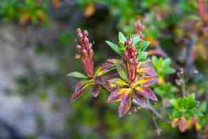
Hairy alpenrose (Rhododendron hirsutum).


