Valais Alps, 8-18 August 2014
← Previous Next → 0 1 2 3 4 5 6 7
Day 6. Col de Tsofeiret.
Lac de Mauvoisin is probably quite touristy in good weather. The path from the lake to Col de Tsofeiret is wide and well marked. The descent on a good path is also straightforward albeit steep. The area around Cabane de Chanrion is a Nature Reserve, and wild camping is prohibited. The Nature Reserve boundary is on the river that comes down from Glacier d'Otemma.
The red line shows our track. The red arrow shows the direction of travel. Shift-click on the track link will open it in nakarte.me.

We pitched the tent in the woodland and managed to set up a spare outer tent so that we can cook and eat under a roof.
In the morning, we went towards Lac de Mauvoisin. It was a huge construction project in the late 50s. The dam is 250 m high and 520 m wide.
 |
 |
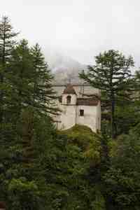
Notre-Dame des Neiges near the Mauvoisin dam. |
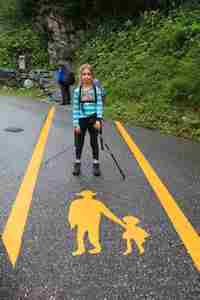
Pedestrian crossing. Sonya interpreted the symbol as "a dad with long ears with a girl in a skirt with a backpack". |
The path leads to a tunnel that goes to the top of the dam. The tunnel was used during the construction of the dam, and now it houses posters which tell the story of the construction. The posters are automatically lit. When we got to the top of the dam, we found ourselves in thick fog.
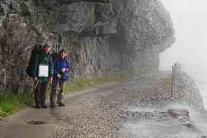
The path along the lake goes through some tunnels. The water was everywhere: on the path, on the rocks, in the waterfalls....

As we were gradually gaining altitude, the visibility improved.
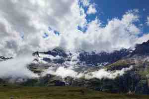
Grand Combin in the clouds. The clouds were rising from the lake and dissolving into the air. The sun came out and warmed us up. We reached Col de Tsofeiret.

We found an edelweiss flower near the pass. We saw another flower the day before, but it was raining and Maria did not bother to get her camera out. We have not seen edelweiss flowers in the Alps before. In the evening, we crossed the river and started our ascent towards Col de Crete Seche. We camped on a flat terrace above the lakes.
Day 7. Our last day - Col de Crete Seche.
We did not meet a sole on the path leading to the pass. The pass is technically easy but the final section is fairly steep and could be challenging in icy conditions.
The red line shows our track. The red arrow shows the direction of travel. Shift-click on the track link will open it in nakarte.me.

That night, the temperature dropped below freezing. The mountains were covered in frost in the morning, and we scraped some ice off the tent.
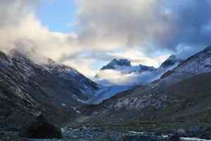
The views were amazing. A sunlit cloud was levitating above Glacier d'Otemma.
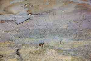
The streams froze. Sonya found some long ice crystals in the mud.
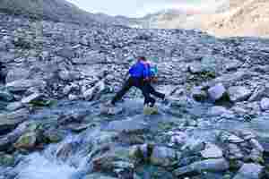
Near the river, the ground was coated with a thin layer of ice. Sonya slipped into the water, and Victor had to carry her to the other side. Col de Crete Seche is seen in the distance.
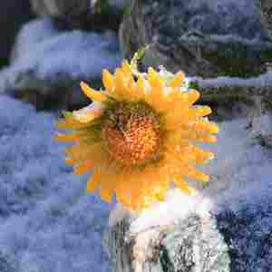
The higher up, the more frost and ice. All flowes were encased in ice crystals. They must be used to large temperature variations.
 |
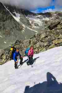 |
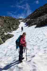
Just below the pass, we came across a very nice snow field. It wasn't quite leading in the right direction, but was so tempting... We put on the crampons and started climbing. Eventually, we had to leave the snow and get back to the path on some rock ledges. Sonya didn't quite enjoy this.
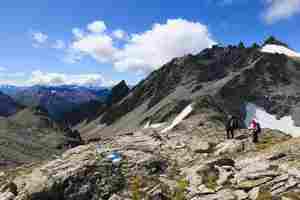
At the crossroads: Switzerland is behind us, Italy is ahead.
It took us a few hours to get down, we lost 1200 m of altitude. It was a bit windy and cold at the top, but quite warm below the tree line. There were loads of mushrooms peppered around the woodland, we picked some for dinner. We got to campsite Lac Lexert in Bionaz. While Maria and Sonya were cooking and looking around, Victor went to fetch the car which we left at a car park one week ago. He had to run/walk 10 km while gaining altitude (450 m) - which took less than 1.5 h altogether! Next morning we drove to the seaside. Out trip was over.


